|
|
|
|
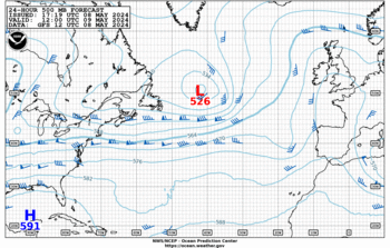
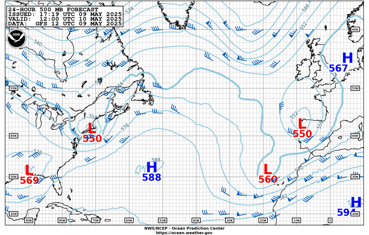
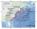
| 24-hour 500 mb |
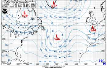
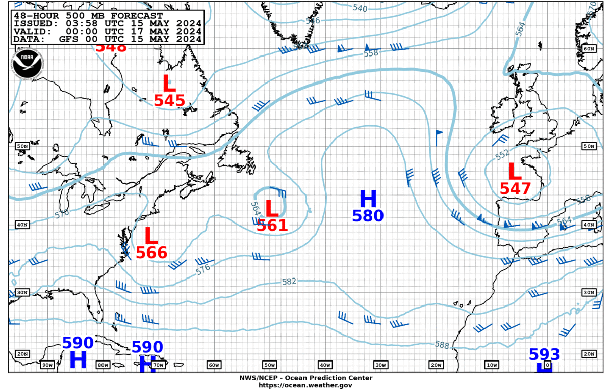
48-hour 500 mb |
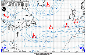
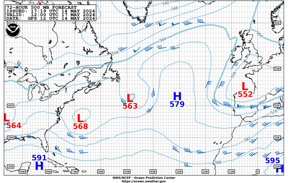
72-hour 500 mb |
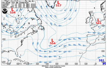
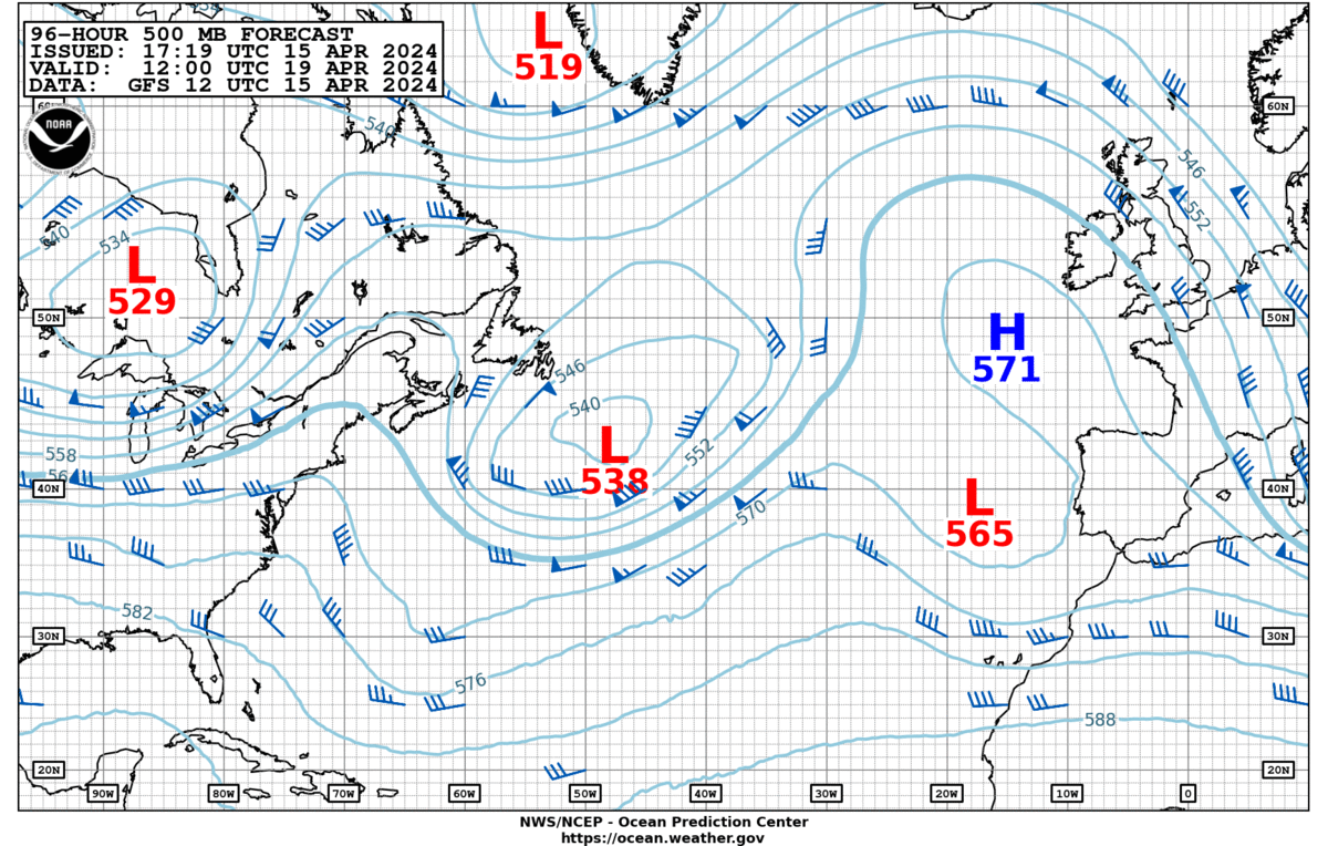
96-hour 500 mb |
| Loop: [3] [7] [14] Days
|
Loop: [3] [7] [14] Days
|
Loop: [3] [7] [14] Days
|
Loop: [3] [7] [14] Days
|
| Updated: Mon, 15-Apr-2024 17:27:01 UTC |
Updated: Mon, 15-Apr-2024 17:35:01 UTC |
Updated: Mon, 15-Apr-2024 17:38:57 UTC |
Updated: Mon, 15-Apr-2024 17:42:53 UTC |
More 500 MB images
|
More 500 MB images
|
More 500 MB images
|
More 500 MB images
|
|
|
|
|
|
|
|
|
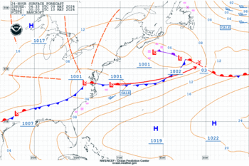
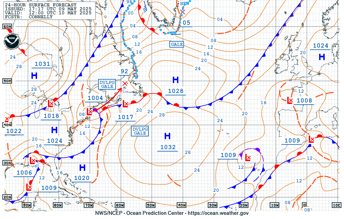
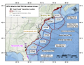
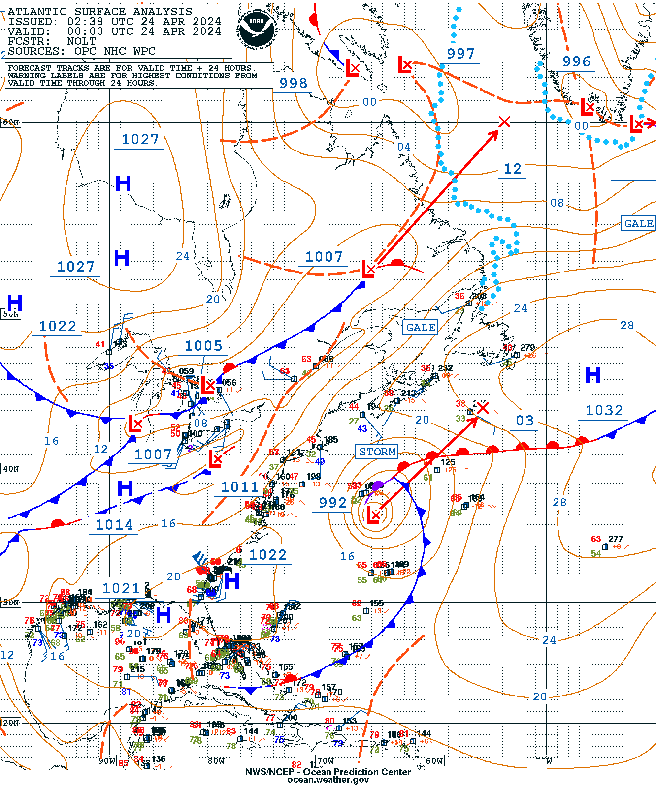
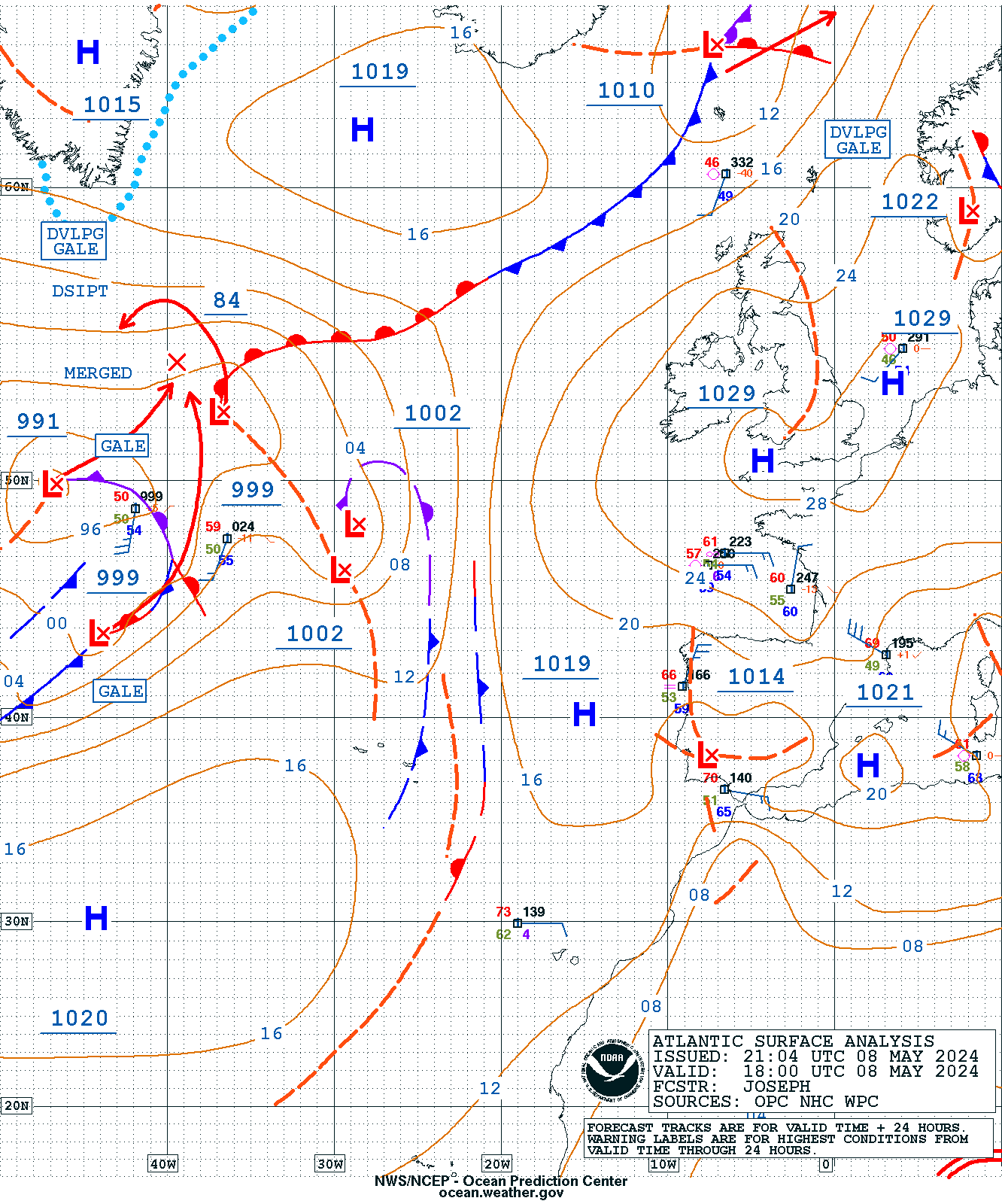
| 24-hour surface |
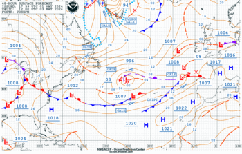
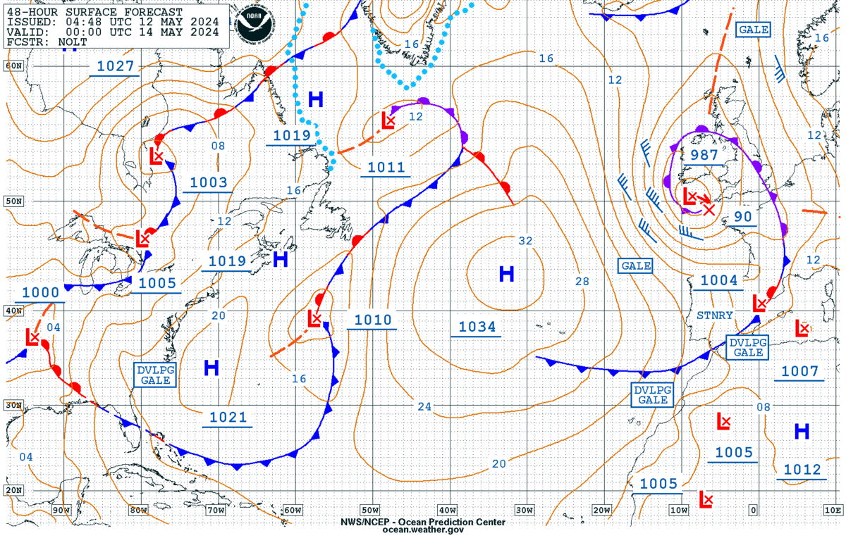
48-hour surface |
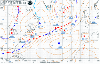
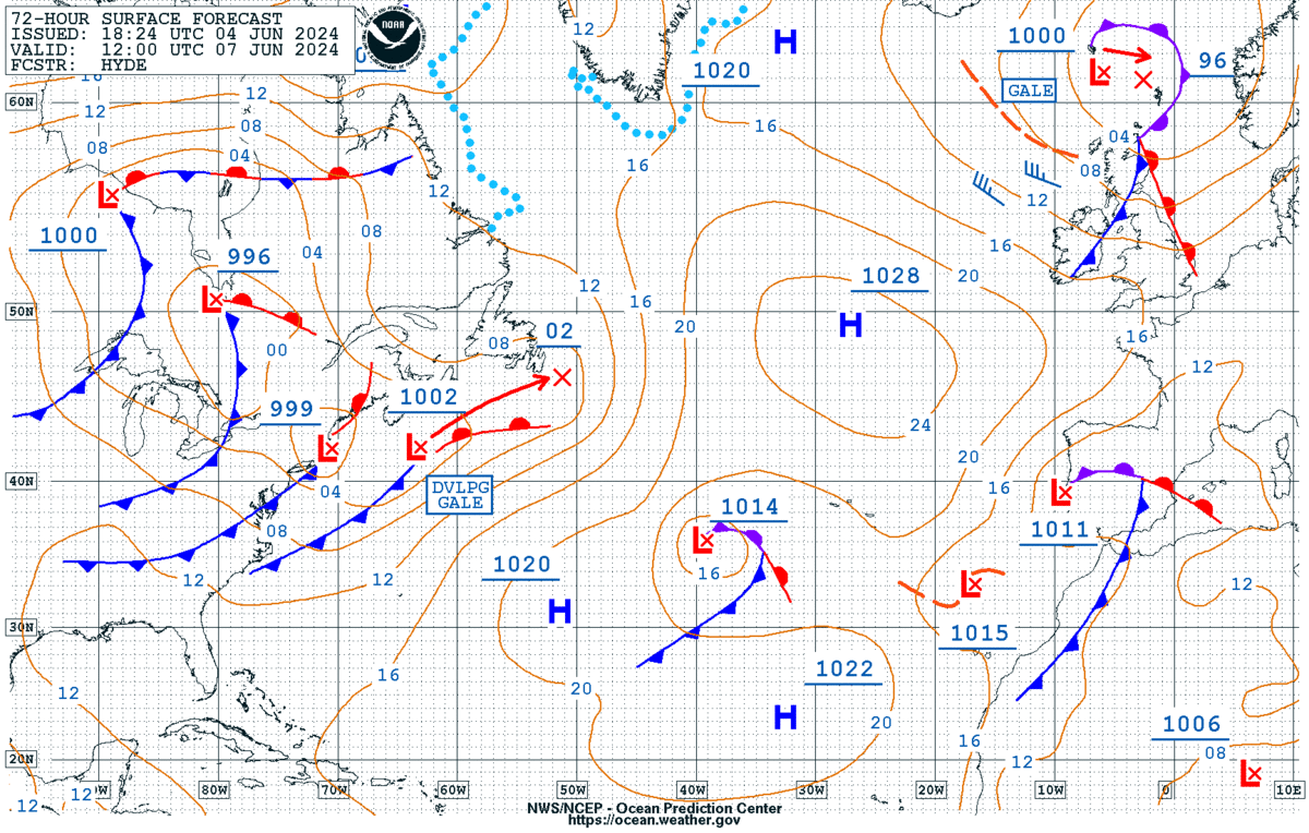
72-hour surface |
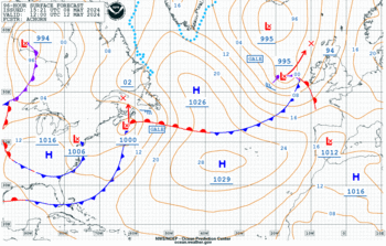
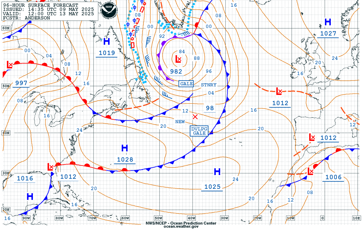
96-hour surface |
| Loop: [3] [7] [14] Days
|
Loop: [3] [7] [14] Days
|
Loop: [3] [7] [14] Days
|
Loop: [3] [7] [14] Days
|
| Updated: Fri, 19-Apr-2024 04:30:13 UTC |
Updated: Fri, 19-Apr-2024 04:46:54 UTC |
Updated: Mon, 15-Apr-2024 20:13:59 UTC |
Updated: Thu, 18-Apr-2024 16:25:53 UTC |
|
|
|
|
|
|
|
|
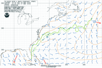
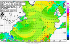
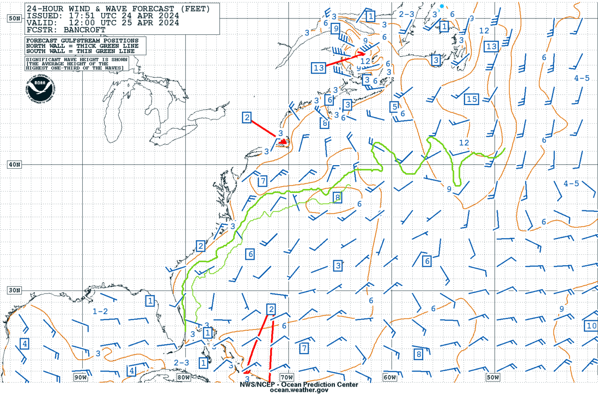
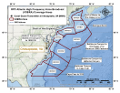
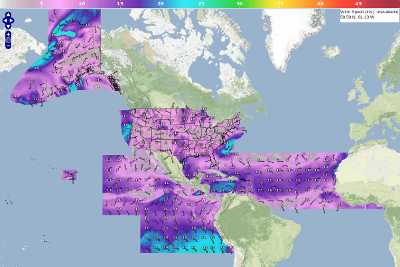
| 24-hour wind & wave |
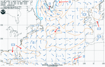
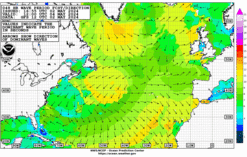
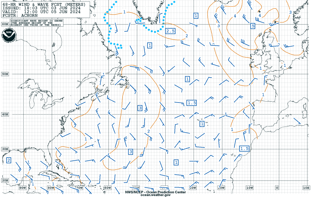
48-hour wind & wave |
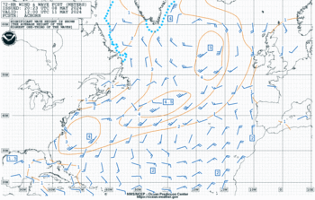
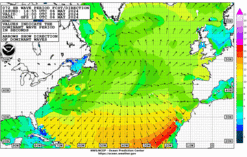
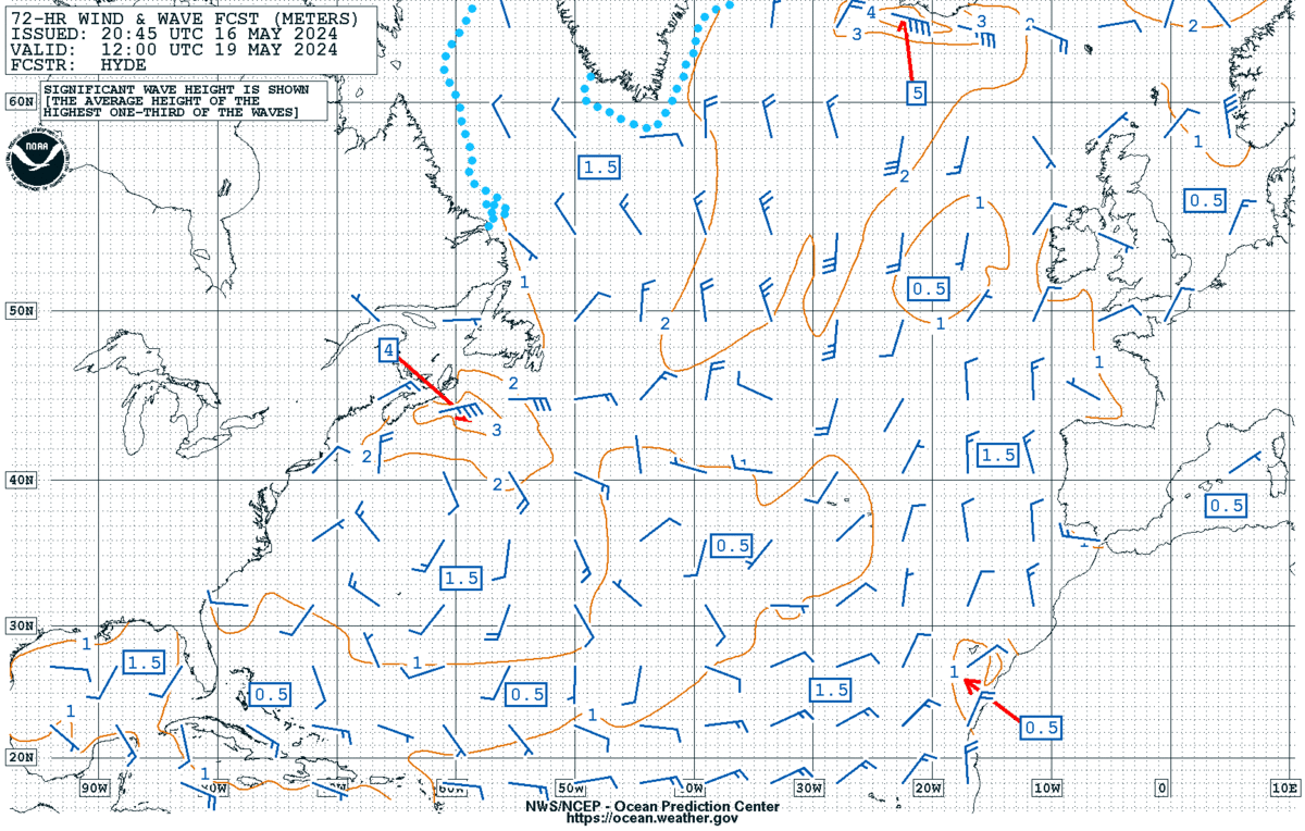
72-hour wind & wave |
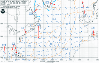
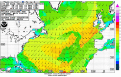
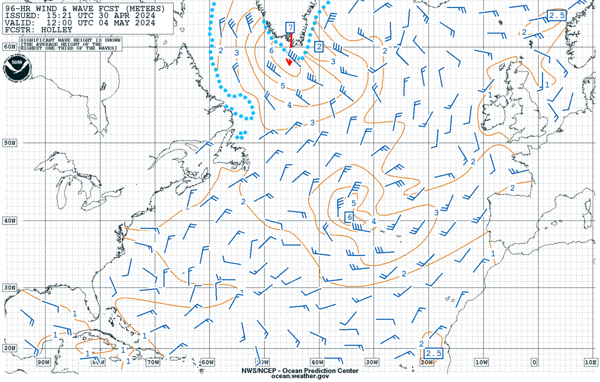
96-hour wind & wave |
| Loop: [3] [7] [14] Days
|
Loop: [3] [7] [14] Days
|
Loop: [3] [7] [14] Days
|
Loop: [3] [7] [14] Days
|
| Updated: Fri, 19-Apr-2024 05:35:07 UTC |
Updated: Fri, 19-Apr-2024 05:23:50 UTC |
Updated: Mon, 15-Apr-2024 20:51:48 UTC |
Updated: Thu, 18-Apr-2024 18:09:18 UTC |
|
|
|
|
|
|
|
|
| 24-hour wave period & direction |
48-hour wave period & direction |
72-hour wave period & direction |
96-hour wave period & direction |
| Loop: [3] [7] [14] Days
|
Loop: [3] [7] [14] Days
|
Loop: [3] [7] [14] Days
|
Loop: [3] [7] [14] Days
|
| Updated: Mon, 15-Apr-2024 17:03:12 UTC |
Updated: Mon, 15-Apr-2024 17:08:50 UTC |
Updated: Mon, 15-Apr-2024 17:12:57 UTC |
Updated: Mon, 15-Apr-2024 17:18:13 UTC |
|
|
|
|


