


Gulf Stream Comparison
** Experimental Product **
The Gulf Stream location in the Global Real Time Ocean Forecast System model (RTOFS) and in the Navy Coastal Ocean Model (NCOM) is compared to the Naval Oceanographic Office (NAVO) Gulf Stream analysis. The Gulf Stream north wall position for ocean models is estimated from the 12 degrees C isotherm at 400 meters. The NAVO Gulf Stream north wall is estimated by analysts using satellite AVHRR SST, ship and buoy data. The NAVO Gulf Stream Analysis can be found at the Naval Oceanography Portal: http://ecowatch.ncddc.noaa.gov/JAG/Navy/data/satellite_analysis/gsnofa.gif?id=3110
Click on thumbnail for larger image.
GLOBAL RTOFS SST with NAVO GS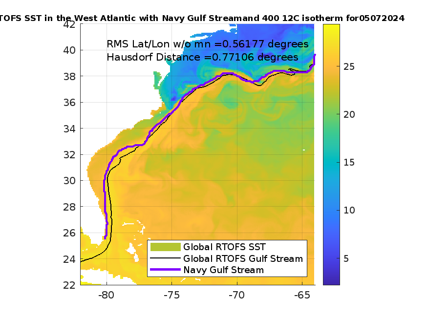
|
GLOBAL RTOFS Currents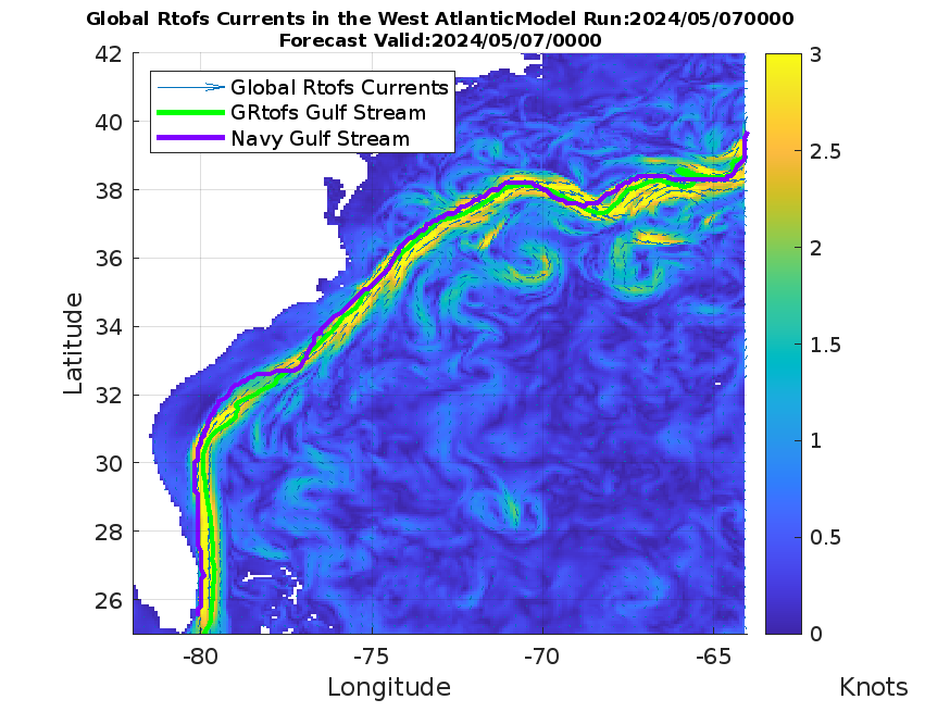
|
NCOM Hi-Res SST with NAVO GS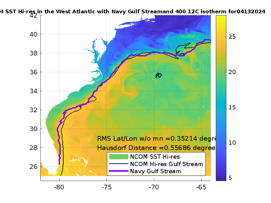
|
NCOM Hi-Res Currents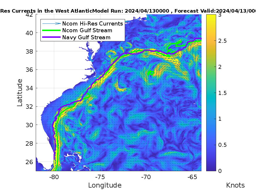
|
STATISTICS DESCRIPTION:
RMS Lat/Lon: Average RMS difference between model and NAVO GS. The minimum of the difference in latitude or longitude at each comparison point is kept.
RMS Lat/Lon w/o mn: Same as RMS Lat/Lon with mean difference of all points removed to remove offset of 12 C isotherm at 400 meters.
RMS Lon w/o mn: Average RMS difference of longitude comparisons at each point.
RMS Lat w/o mn: Average RMS difference of latitude comparisons at each point.
Hausdorf Distance: The directed Hausdorf distance from the Navy GS to Model GS. For more information, see http://cgm.cs.mcgill.ca/~godfried/teaching/cg-projects/98/normand/main.html