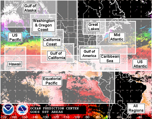
GOES Satellite-Derived Sea Surface Temperatures

Displaying data for .

Mouseover the region name and select the field type from the drop down list)

Image map of GOES Satellite-Derived Sea Surface Temperature Areas
GULF OF ALASKA GOES Sea Surface Temperatures WASHINGTON & OREGON COAST GOES Sea Surface Temperatures CALIFORNIA COAST GOES Sea Surface Temperatures GULF OF CALIFORNIA GOES Sea Surface Temperatures HAWAII GOES Sea Surface Temperatures EASTERN EQUATORIAL PACIFIC GOES Sea Surface Temperatures WESTERN EQUATORIAL PACIFIC GOES Sea Surface Temperatures MID ATLANTIC GOES Sea Surface Temperatures GREAT LAKES GOES Sea Surface Temperatures GULF OF MEXICO GOES Sea Surface Temperatures CARIBBEAN SEA GOES Sea Surface Temperatures ALL REGIONS GOES Sea Surface Temperatures

The graphic above contains links to GOES satellite-derived sea surface temperature (SST, degrees Celsius) data for the Western Atlantic and Eastern Pacific Oceans. There are three main data fields available covering each of the twelve regions and all regions combined. The data fields are sea surface temperature with compositing options described below, age of observations and the number of observations. The GOES East SST composites are generated from the NOAA NESDIS ACSPO (Advanced Clear Sky Processor for Ocean) 0.02ยบ Level 3 product from the new-generation Advanced Baseline Imager (ABI) sensor onboard the GOES-16 (East) satellite.

The data fields are displayed as composite images calculated from the most recent hourly GOES infrared satellite data. All SST fields are average values of the available data over the stated period, except for Goes East regions that provide the option of using the most recent data over the last 4 days, the 4 Day Recent Composite. Areas with no valid data over the 4/5 days due to persistant cloud cover are shown in black (Goes West) or white (Goes East).

Blue areas in the Observation Age and Observation Numbers fields show the most recent data and the greatest quantity of data, respectively. Once the new GOES West satellite becomes operational and we receive SST data, the images for GOES West will be changed to the style of the Goes East regions.