-
Analysis & Forecast
- Weather
- Ocean
- Ice & Icebergs
- Other Hazards
-
Data
- Digital Forecasts
- Electronic Marine Charting (ECDIS)
- Environmental
- Freezing Spray
- GIS
- Observations
- Ocean
- Past Weather
- Probabilistic Guidance
-
Information
- Product Information
- Receiving Products
- About OPC
-
Social Media
-
Search
| Hurricane Warnings in Effect | Pacific: High Seas EP1 and EPI |
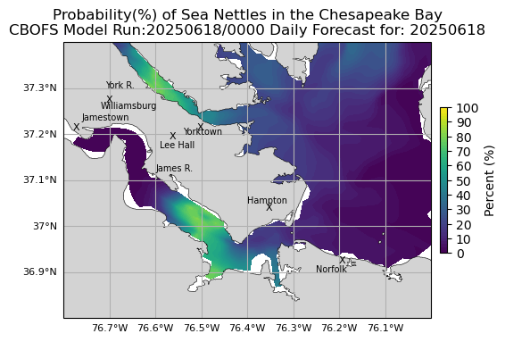
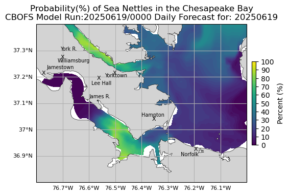
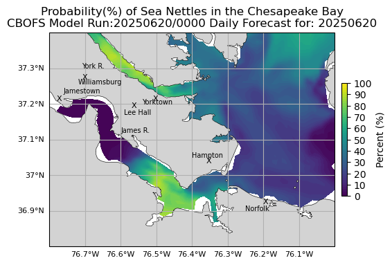
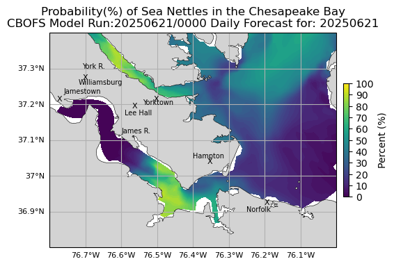
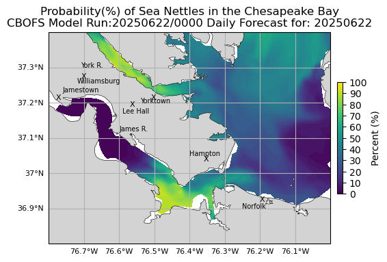
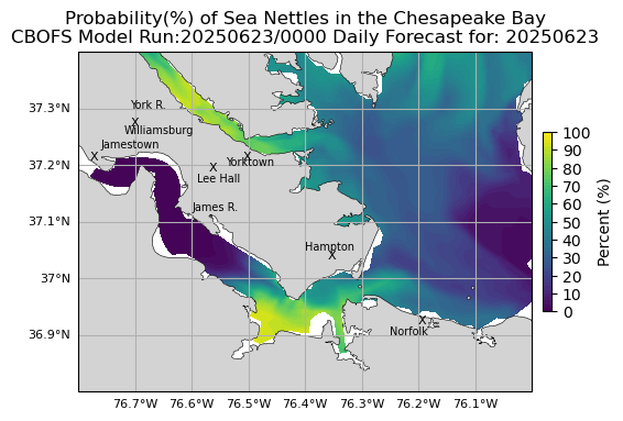
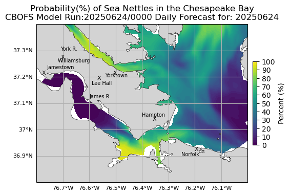
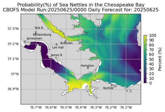
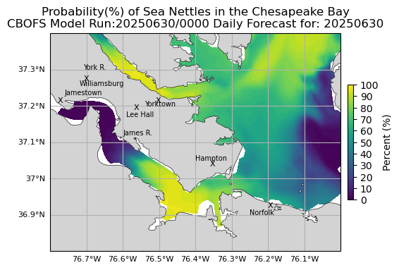
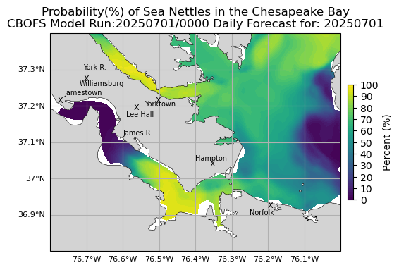
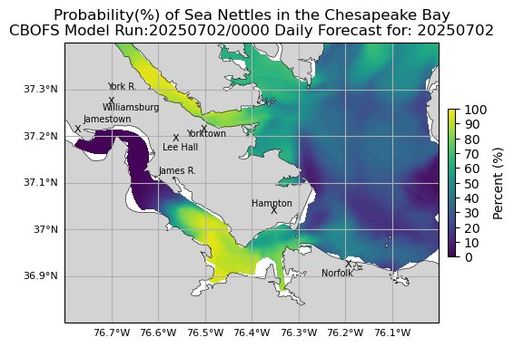
Sea Nettles Probability of Encounters (Experimental)
Use the drop down menus below to change the display.
- Data:
Sea Nettles Probability of Encounters (Experimental)- GOES Satellite-Derived Sea Surface Temperatures
- Global RTOFS High Resolution Oceanic Model
- NCOM High Resolution Oceanic Model
- Sea Nettles Probability of Encounters (Experimental)
- Area:
James River - Loop:
Off- On
- Off
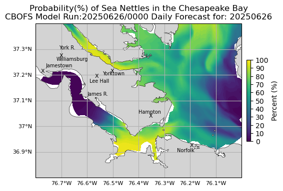
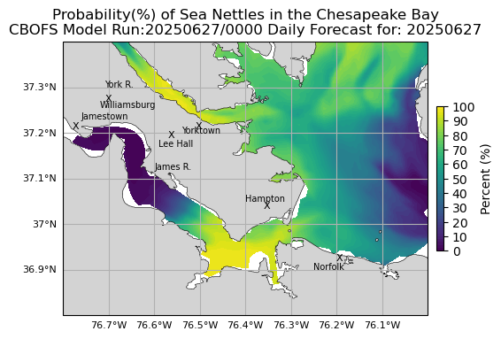
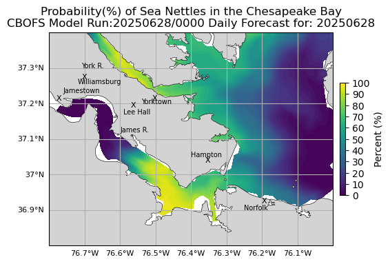
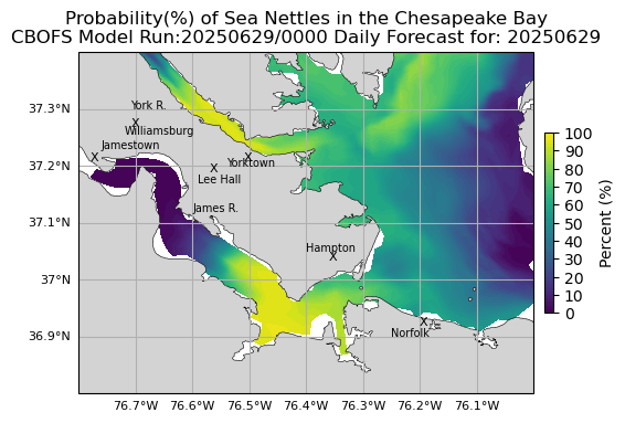
The jellyfish often encountered in the Chesapeake Bay in the summer is the sea nettle Chrysaora chesapeakei. Knowing where and when to expect this biotic nuisance may help to alleviate an unpleasant encounter.
These maps are experimental and depict the probability of encountering sea nettles (not their abundance or density) in the Chesapeake Bay area. The density of sea nettles that you may encounter is not reflected here because it can vary greatly from year to year at a given location and would be a much less reliable prediction.
| Most Recent Images First |
 |
 |
 |
 |
 |
 |
 |
 |
 |
 |
 |
 |
 |
 |
 |
 |


