| Hurricane Warnings in Effect | Pacific: High Seas EP1 and EPI |
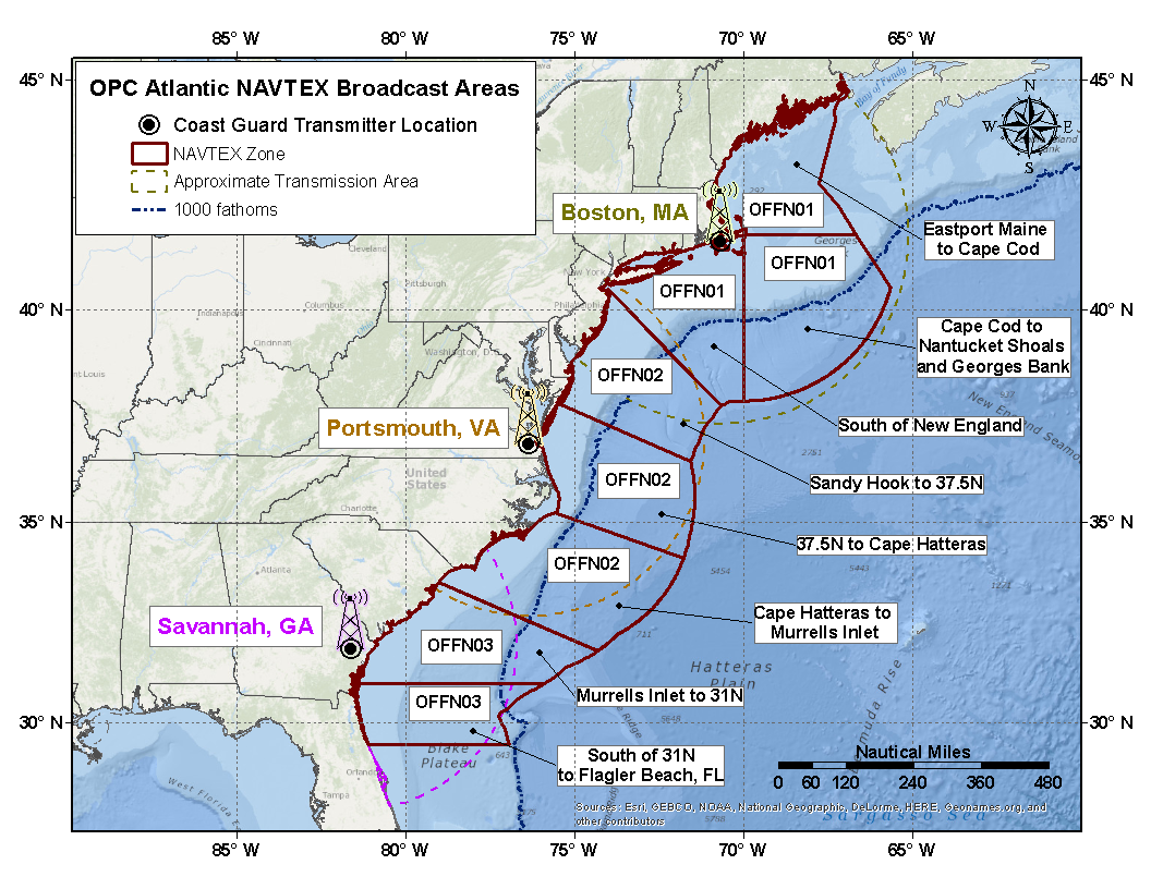
About Coastal & Offshore Waters Forecast (NAVTEX)
This forecast includes both the area of the coastal and offshore waters. For specific information refer to either the offshore or coastal forecasts. The forecast includes expected winds, seas, reduced visibility, and any precipitation.
The synopsis has a brief description of significant weather features and forecasts over the coastal & offshore waters through the forecast period. Emphasis is on the movement of low pressure, high pressure, fronts, and tropical systems. It covers a smaller area and contains more detailed information than the High Seas Forecast.
With respect to wind warnings the maximum sustained winds over a ten minute period (momentary gusts may be higher) is used in the offshore and sustained or frequent gusts to warning criteria is used in the coastal areas within a 24 hour period.
Warnings- "Gale" refers to extratropical lows or an area with winds ranging from 34 knot (39 mph) to 47 knots (54 mph).
- "Storm" refers to an extratropical low or an area with winds of 48 knots (55 mph) or greater.
- "Hurricane Force" refers to a extratropical low or an area of winds in excess of 64 knots or higher(74 mph).
- "Tropical depression" refers to tropical low with 1 minute sustained winds of less than 34 knots (39 mph).
- "Tropical storm" refers to tropical low with 1 minute sustained surface wind of 34 knots (39 mph) to 63 knots (73 mph).
- "Hurricane" refers to tropical low with 1 minute maximum sustained surface winds 64 knots (74 mph) or greater.