| Hurricane Warnings in Effect | Pacific: High Seas EP1 and EPI |
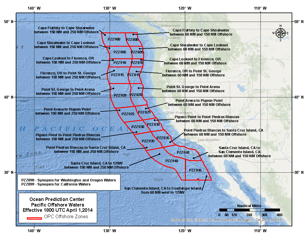
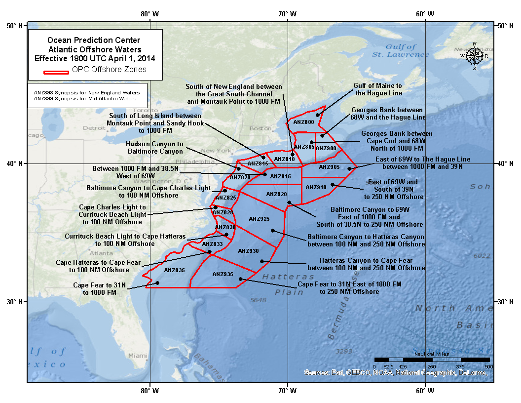
About Offshore Waters Forecast
The forecast includes a synopsis for the next 5 days. The synopsis and outlook has a brief description of significant weather features and forecast over the offshore waters through the forecast period. Emphasis is placed on the forecast movement of low pressure, high pressure, fronts, and tropical systems. It covers a smaller area and contains more detailed information than the High Seas Forecast.
The forecast includes expected winds, seas, reduced visibility, and any precipitation. Emphasis in the forecast is for systems with maximum sustained winds (over a ten minute period) in excess of 34 knot (39 mph) and areas with reduced visibility of less than 1 NM. A warning is issued when wind conditions are expected to exceed 34 knot (39 mph) within a 24 hour period. The term "Gale" refers to extratropical lows or an area with maximum sustained winds (averaged over a ten minute period, momentary gusts may be higher) ranging from 34 knot (39 mph) to 47 knots (54 mph). A "Storm" refers to an extratropical low or an area with sustained winds (averaged over a ten minute period, momentary gusts may be higher) of 48 knots (55 mph) or greater. Hurricane Force refers to a extratropical low or an area of sustained winds (averaged over a ten minute period, momentary gusts may be higher) in excess of 64 knots or higher(74 mph).
A "Tropical depression" has maximum 1 minute sustained surface wind of less than 34 knots (39 mph). A "Tropical storm" has maximum 1 minute sustained surface wind of 34 knots (39 mph) to 63 knots (73 mph). A "Hurricane" has maximum 1 minute sustained surface winds 64 knots (74 mph) or greater.
The offshore forecast is issued every 6 hours for the Western North Atlantic and Eastern North Pacific Oceans. It may be issued sooner when current or expected conditions differ significantly from the forecast.