


About Offshore & Adjacent Waters Sea State Analysis
Manually produced analysis of sea state produced for 3 hour intervals for offshore and
adjacent waters of the Atlantic and Pacific Oceans. These graphics are used by the Ocean
Prediction Center for its 24 hour "watch" on winds and sea state conditions in
its regional area of responsibility. These graphics also provide guidance for National
Weather Service Forecast Offices with coastal water responsibility on the west and east
coasts of the U.S. . The charts depict the analyzed significant sea state at 3 foot height
contour intervals. The central value of significant wave heights imply
that higher individual waves are possible. The data comes from ships and buoys. It may include data
from polar orbiting satellites such JASON data which shows sea state values in narrow swaths under the orbital path.
In areas of sparse data, model guidance and continuity is used to make an estimate of
significant sea state. Reported sea state from buoys and ships is in feet and is colored green.
The period of predominant swell wave is in seconds and is colored bright blue. The swell direction
is shown by the white arrows, and the reported wind speed and direction is shown by the yellow arrows.
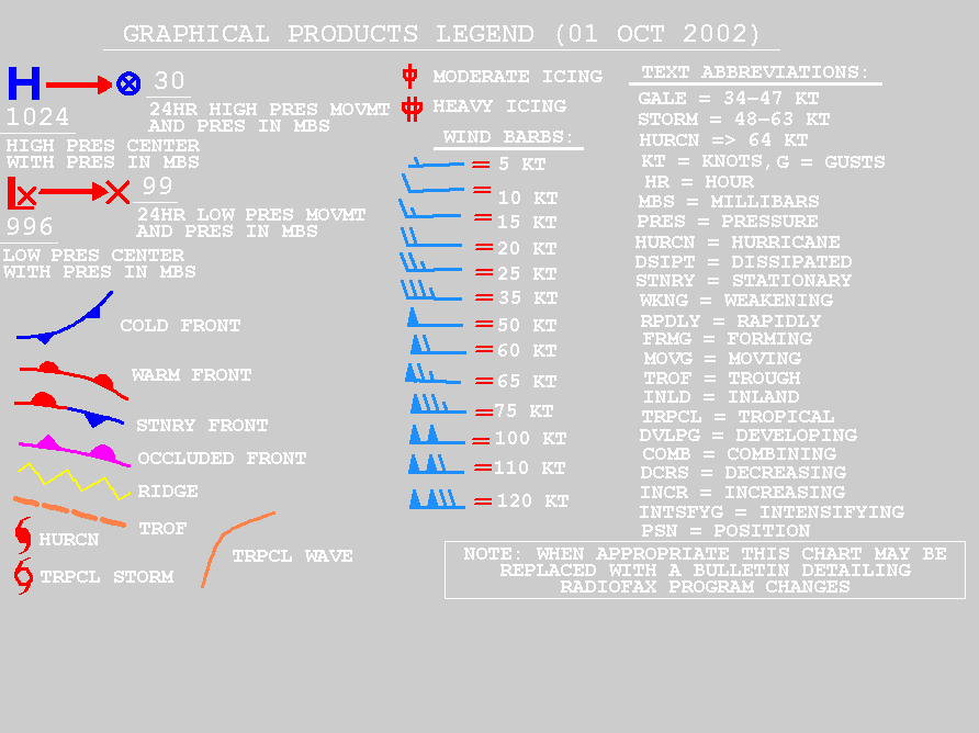
Additional information about the graphical products legend is available
at http:///product_description/PLBZ04.GIF.
OPC's Product Guides are available at https://ocean.weather.gov/product_guides.php.